EPI by bike. From Corbera to Gavà

REMINDER: It is recommended to divide the route into stages according to your physical level.
We will depart from Corbera. The agro-forestry landscape at the beginning changes completely, and now, once we leave the vineyards of the Anoia valley, the forest cover becomes continuous all the way to the town of Castelldefels. In the Vall del Llobregat, this mountain range is known as the Muntanyes d'Ordal, and further west, near Penedès and down to the sea, it is the Serra del Garraf.
This forest cover changes slightly in the shaded areas and streams, where oaks, holm oaks, and other deciduous trees gain prominence. Also here, the undergrowth of rosemary, mastic, and kermes oak is replaced by thickets.
We will cross urbanised areas through Corbera de Llobregat, Vallirana, and Begues, separated by forests of white pine in different stages of development as a result of past wildfires.
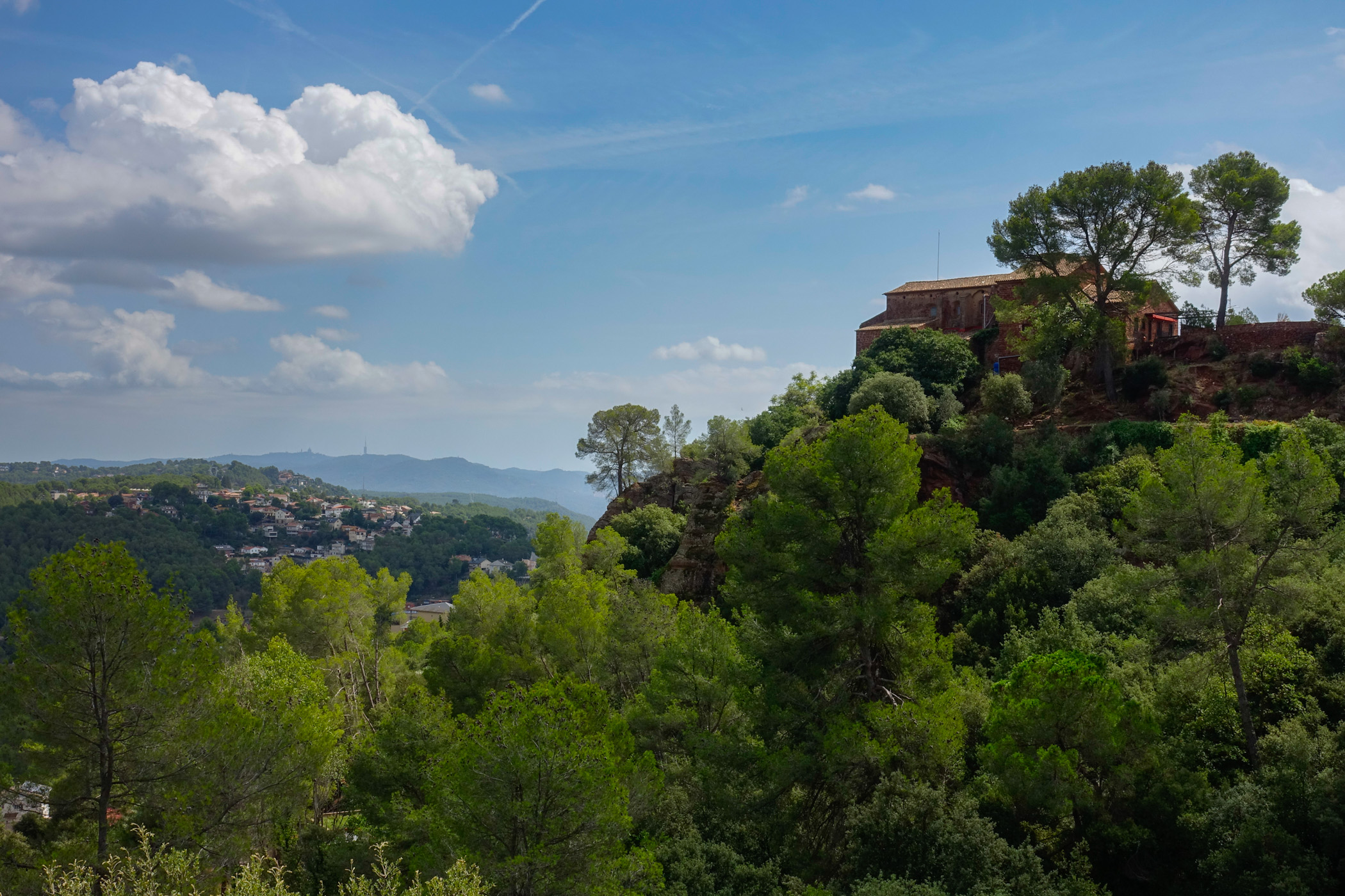
In Corbera, we will pass by the old town of Castell and the església de Santa Maria, and then we will reach the beautiful spot of the Monestir of Sant Ponç, to climb up passing the "font Freda" (Cold Fountain) towards Coll Verdaguer, above Vallirana. We will descend into the town and climb all the way up the Can Bogunyà valley and the Vall d'Arús, formerly a breeding ground for the booted eagle, to then climb to the Penya del Moro (467 m), where we will enjoy views of the towns of Sant Climent, Torrelles, and Begues.
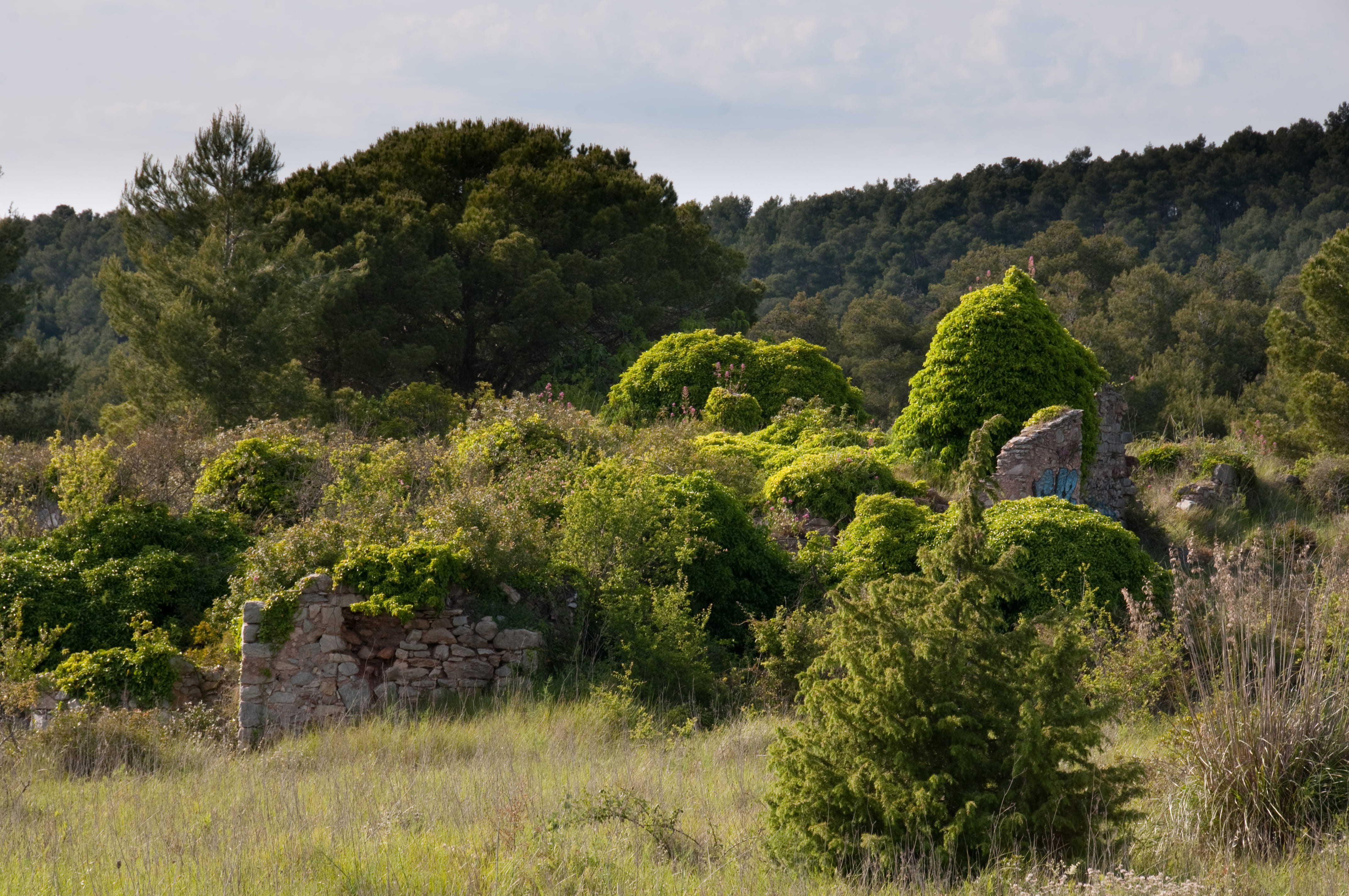
We will descend to the agricultural plain of Begues and, crossing the town and passing by the església of Sant Cristòfol, we head toward the Clota (a set of ruins, dated from the 14th century). From the Coll de la Clota, we will descend to La Sentiu.
If you're riding a MTB, we will take the main trail. A long and fast descent through the shaded area of the Serra de Perers, passing by some ruined farmhouses. This is the trail known as the "Camí dels Penitents."
For those of us walking, we will take a narrow path, the GR 92, which was used to connect the neighbourhoods of Clota with Eramprunyà and Bruguers, without having to make a detour around the Puig de la Desfeta (516 m).
We are at the head of la vall de la Sentiu. Once agriculture disappeared, the pines began to colonise the space, and later, wildfires caused shrubs to become the most abundant. The young pine forests, like the ones we’ve been crossing, are reclaiming the space over the shrubs.
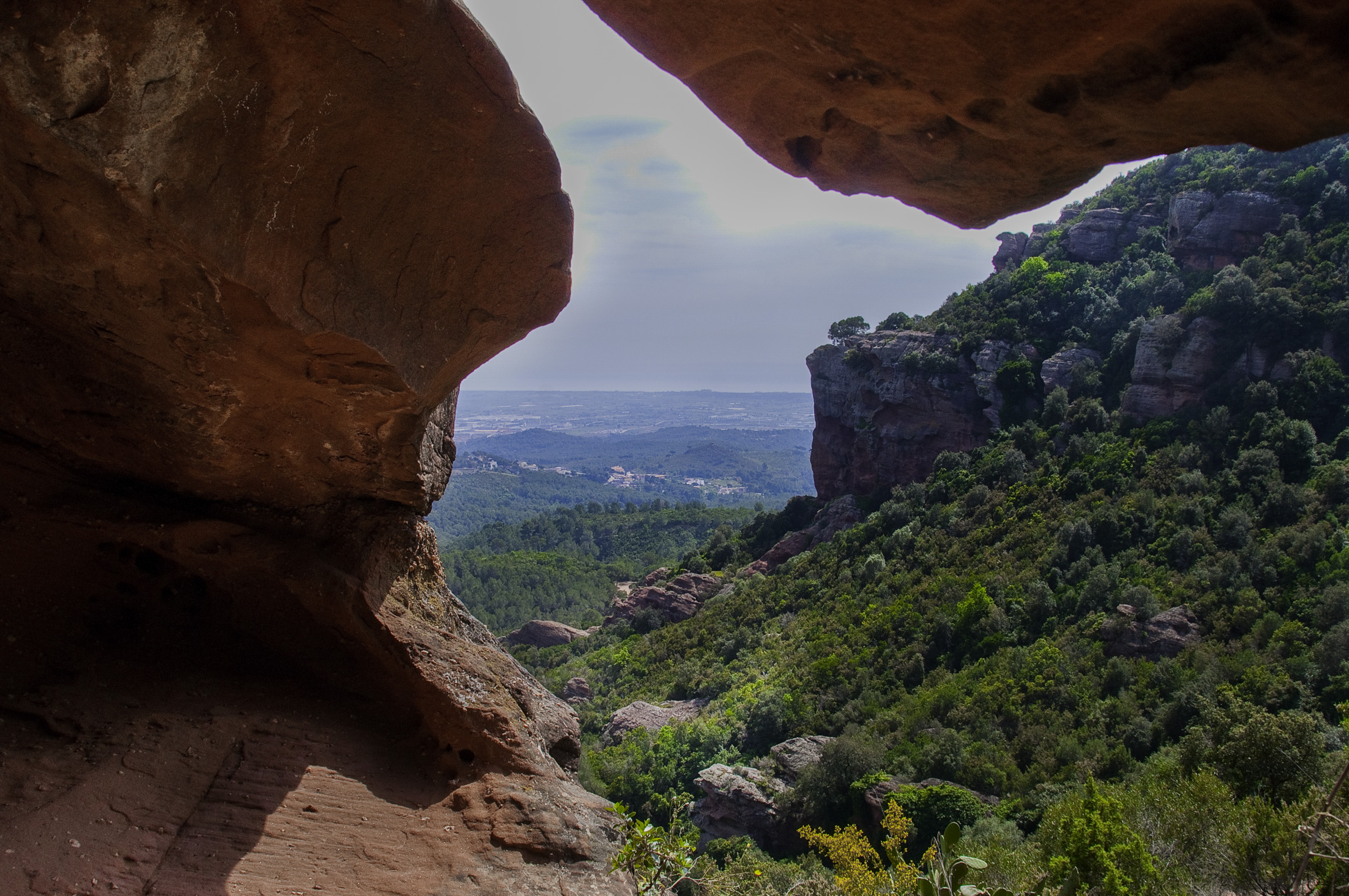
On foot, after skirting the Castell d'Eramprunyà, a steep descent that passes near the "roca foradada" (the holey rock) takes us to the Bruguers hermitage, where we join the comfortable trail that descends toward La Sentiu, where we meet the MTB trail again.
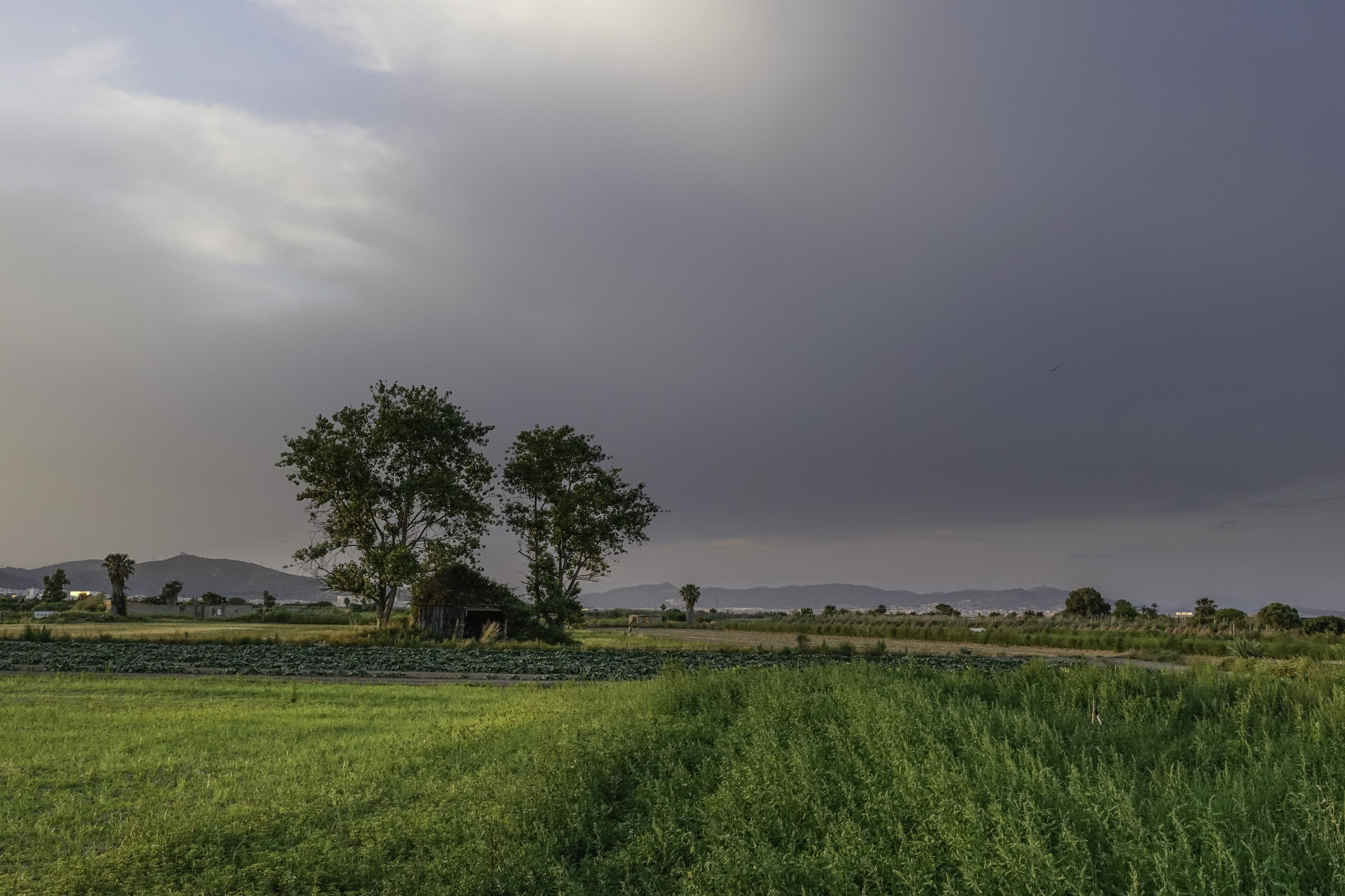
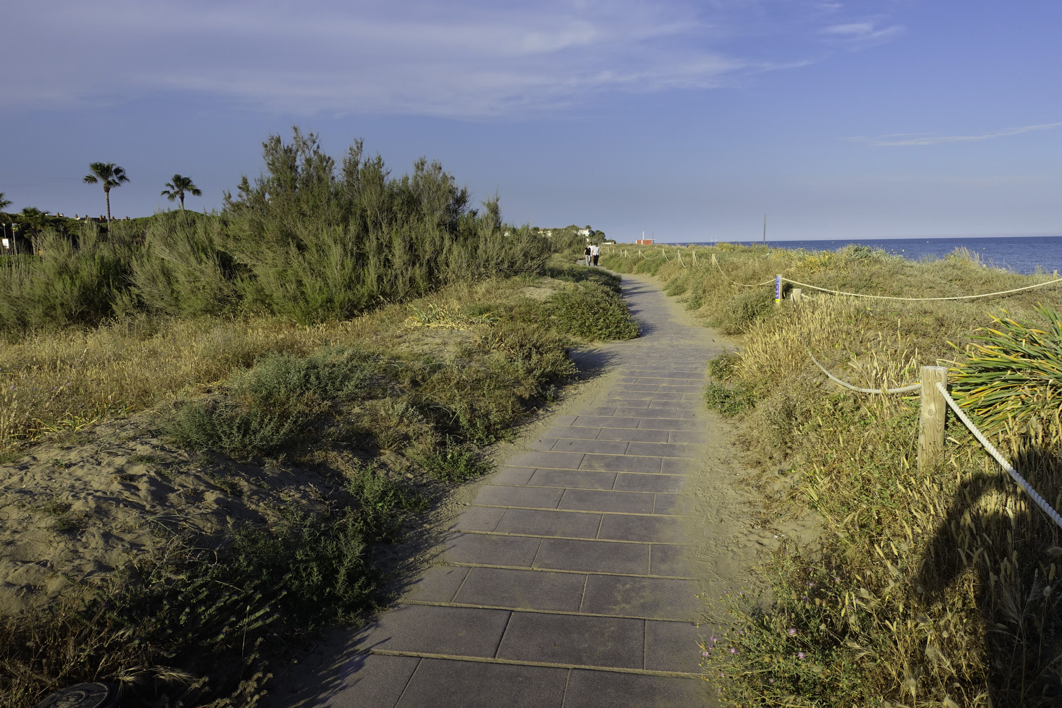
Now, through a patch of disturbed pine forest, we head toward el Castell de Castelldefels. We will then descend, crossing the town toward the plain, where all agricultural traces of this corner of the delta have disappeared, except for some pine trees. Surrounded by residential areas, we pass the C-32 and C-31 roads and arrive at the Parc del Mar at the Platja de la Pineda.
Technical sheet
Points of interest


ROUTE
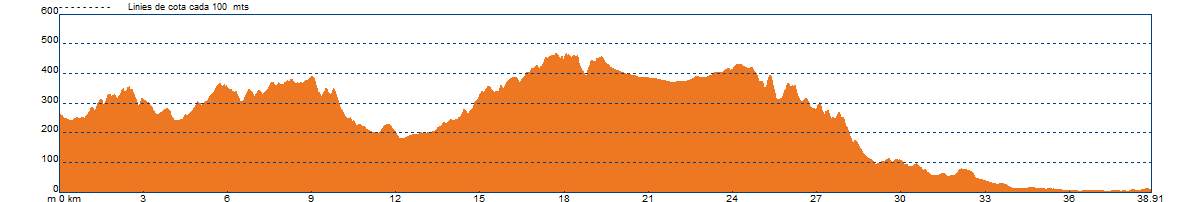
- It is recommended to divide the route into two or three stages according to your physical level.
- The section from Monistrol to Corbera should be done using the EPO route, ending in Viladecans, and when you arrive in Corbera, select the EPI route, ending in Castelldefels.
- We will mostly be on trails, with a smaller percentage of urban asphalted sections and paths.
- For MTB riders, in Vallirana, the Can Bogunyà sector, and the margin of Moro, some uphill paths are not rideable. Read the possible variants suggested by NL, which you will need to visualize on maps.
- In the towns, you might pass through some streets in the opposite direction. Be cautious.
- There are steep but short ascents.
- If you have an overview of the track, you may find possible shortcuts.
- The flags will guide you regarding the location and direction to follow. If you come across an intersection without flags, follow the main trail and check the warnings on your mobile.
- It is better to download the route offline.
- Although you will find trail markers like GR or SL along the way, don’t worry; it’s better to follow the track and the flags. Routes of the Baix Llobregat. Eix de Ponent (EPO).
- Save as much battery as possible on the mobile you are using for navigation.
WATER
- There are water fountains in the towns you pass through.
PRECAUTIONS
- There will be motor vehicle traffic in the urban areas and also on some forest tracks.
- Pace yourself.
- Don’t forget to eat and especially drink.
- Respect private property and the natural environment.
- Do not leave trash on the trail.
- Be cautious of flood-prone fords in streams if it has rained (Corbera, La Sentiu).
- There are steep and long descents, such as the Camí dels Penitents toward La Sentiu, where you need to regulate your speed.
WEATHER
- Check the weather forecast.
- Foggy days may spoil this outing.
EQUIPMENT
- Comfortable and season-appropriate cycling clothing.
- Don’t forget safety gear: helmet and gloves.
- Basic spare parts, especially for repairing punctures.
- A camera and access to a map to know your location in case you need to find a shortcut.
OTHER EQUIPMENT
- Upon entering each town, you will find an information panel about the route.
- Along the way, there are posts with flags indicating your location, nearby points, and possible route variants.